Transportation
The metropolis of Tehran enjoys a huge
network of highways (280 km) and of interchanges’ ramps & loops
(180km). In 2007 there were 130 kilometers of highways and 120
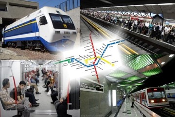
kilometers of ramps and loops under construction. In 2001 a metro
system that had been in planning since the 1970s opened the first
two of seven envisaged lines. Work has been slow and coverage
remains very limited. Development of the Tehran metro system had
been interrupted by the Islamic Revolution and the Iran-Iraq War.
Problems arising from the late completion of the metro led to buses
taking on the role of the metro lines, serving mainly long distance
routes. Taxis filled the void for local journeys. The taxis only
drive on main avenues, and only within the local area, so it may be
necessary to take several taxis to get to one's final destination.
This has all led to extreme congestion and air pollution within the
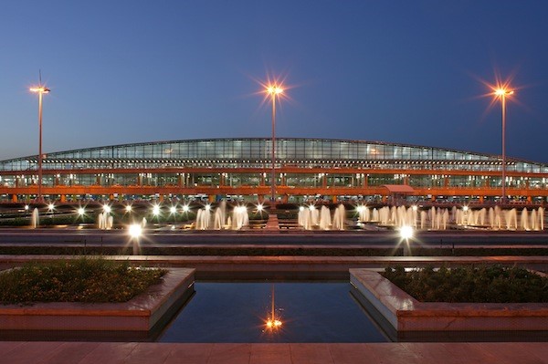
city. Tehran is served by Mehrabad International Airport, the old
airport which doubles as a military base located in the western
part of the city, and Imam Khomeini International Airport, 50
kilometres (31 mi) south, which handles flights from the Persian
Gulf but which will eventually handle all international flights.
Tehran also has a central train station with connecting services
round the clock to various cities in the country. There are four
bus terminals that also provide connections at low fares. These are
the South, East, West, and Bei-haghi Park-Drive Terminals. While
the center of the city houses the government ministries and
headquarters, the commercial centers are more located toward
Valiasr Street, Taleghani Ave, and Beheshti Ave further north.
Although administratively separate, Rey, Shemiran, and Karaj are
often considered part of the larger Tehran metropolitan area.